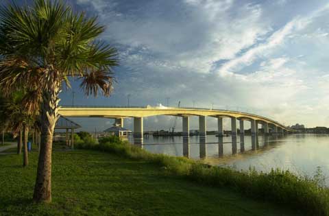
In Florida, low elevations can make transportation infrastructure in coastal and low-lying areas potentially vulnerable to sea level rise (SLR). Because global SLR forecasts lack precision at local or regional scales, SLR forecasts or scenarios for parts of the state have been prepared using varying tools and approaches. However, Florida still lacks a consensus on the appropriate methodology to forecast potential, adverse impacts. Also, a comprehensive analysis of transportation infrastructure potentially at risk in Florida from SLR has not been conducted.
In this project, Florida Atlantic University researchers analyzed findings, including data sources and methodologies used to forecast SLR. They recommended data sources and methods for forecasting SLR and related impacts in Florida and investigated integrating SLR forecasts with FDOT information systems to identify atrisk infrastructure. Using the Weiss Overpeck 1-meter (~3 ft) estimate of SLR to illustrate the methodology, researchers linked mapping software and datasets to create a framework for identifying
transportation facilities at risk.
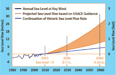
Analysis of advantages and disadvantages of various SLR research studies, combined with workshop reports and expert consultation, led the researchers to recommend that FDOT use the U.S. Army Corps of Engineers (USACE) sea level change guidance, which will be revisited in 2013-14, for forecasting SLR in Florida. USACE guidance considers scenarios of possible future rates of mean sea level change over various planning horizons, which can be used to identify and assess infrastructure vulnerabilities and inform decisions about possible SLR impacts and adaptation actions. Southeast Florida developed consensus projections using the USACE guidance. While these projections will be useful for a statewide analysis, local conditions of coastline uplift or subsidence should be taken into account in regional projections. Researchers also recommended more refined downscaling analyses to produce more accurate analyses of potentially vulnerable transportation facilities.
The methodology used ArcGIS to fuse the Weiss Overpeck 1-meter SLR map for Florida with map data on roadways. Stepwise downscaling then generated candidate road segments and confirmed their vulnerability, first with LiDAR data, where available, and finally with on-the-ground inspection. The methodology was demonstrated by application to Dania Beach, the Charlotte Harbor/Punta Gorda area, and the Florida Keys.
The researchers suggested several responses to SLR, including developing a sketch-planning tool of the framework to identify facilities at risk and building SLR impact into FDOT decision making and transportation design and construction processes. The final project report includes helpful appendices that detail the literature related to SLR, data gaps, planning implementation tools for adaption to SLR, and a summary of SLR impacts on the wide variety of transportation structures and facilities.
Download a copy of the Summary
Download a copy of the Final Report.
Project Manager: Maria Cahill, AICP, FDOT Planning Office
Principal Investigator: Dr. Leonard Berry, Florida Atlantic University
For more information, visit http://www.dot.state.fl.us/research-center