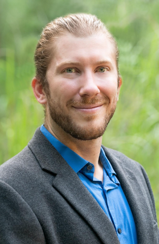
 Vince Edwards
Vince Edwards began working at CES in the spring of 2016 as a Graduate Research Assistant, primarily as supplementary support in the planning of the most recent Sea-Level Rise Summit. His focus switched to working with staff and fellow graduate students on a Coastal SEES grant investigating the ecological and social implications of sea-level rise on several long-term ecological research (LTER) sites along the Atlantic coast under direction of advisor Dr. Colin Polsky.
He completed his undergraduate work at Penn State, developing a foundation in a broad array of topics, including climate change science, human geography, and systems modeling; Then he began his Master’s in Environmental Science from Florida Atlantic University. His interests include the social and economic repercussions of sea-level rise, public outreach and engagement, and sustainable design.
I was living in South Florida at the time and decided I wanted to return to school to advance the environmental education I had received as an undergrad. The ecosystem/human interactions in South Florida are very interesting to me, and I loved the programs and opportunities that FAU had to offer. I was lucky to be able to work under Colin Polsky and alongside the staff at the CES—our academic interests aligned at that time, and it ended up being a great match!
I earned a Master of Science with a major in Environmental Science in December 2017.
I previously earned a Bachelor of Science with a major in Earth Science from Penn State, and was eager to consider that academic focus. While living in South Florida, I spent a ton of time at the beach (on both coasts) and in the Keys, as well as visiting wetlands down on the edges of the Everglades, and became really interested in human impacts to those ecosystems.
Prior to jumping into thesis work, I had the opportunity to work on planning and putting on the 3 rd Annual Sea Level Rise Summit with CES staff and several graduate colleagues. The experience was extremely rewarding, and I’m very thankful that I had the opportunity to dive so deeply into that work before shifting focus to work on a National Science Foundation grant that would lead to my master’s thesis work.
My thesis focused on human perceptions of ecosystem value, specifically the value local communities place on coastal salt marshes. Our team conducted focus group interviews in three small coastal communities, comparing qualitative perceptions of ecosystem value to a large body of existing research that traditionally has focused on quantitative economic valuations of ecosystems.
I often think about the Sea Level Rise Summit and the travel to coastal communities in Massachusetts and Virginia. I stumble across photos of these events in my photos folder occasionally, and always reminisce about those experiences when I do.
I have been working as a GIS Analyst and Developer in the environmental field since I left FAU. While in school, I worked for a regional planning agency, conducting sea-level rise modeling and coastal community vulnerability assessments. After leaving South Florida, I worked for a small environmental consulting firm managing spatial data collected by field scientists during wetland assessments, endangered species surveys, and forestry work. During this time, I did quite a bit of cartography, and began getting into Python development. These days I am a contractor working with the Bureau of Land Management assisting with data management and general automation. In this role I get to interact with folks spread all over the West, helping with their data (usually environmental) needs.
Get involved with some field work if you can! During my time working on sea-level rise I was often able to get out to the coast to witness and measure King Tides and view flood damage. In another job, I was able to get out and assist with wetland delineations and forestry assessments before going back to a desk to do the post-processing, cartography, and reporting. And still today I get out to Bureau-managed land and meet with folks who work primarily in the field. For me, this has helped keep me connected to the work and the environmental aspects, rather than working 100% at a desk. I also recommend getting, at a minimum, a basic understanding of GIS applications. GIS is pretty ubiquitous in the environmental field, and many others, so having a familiarity is a leg up on job applications.
I love spending time outdoors. I go hiking, car camping, backpacking, or snowboarding most weekends (depending on the time of year!). I also love living in Denver, and walk around the city exploring new restaurants, bookstores, and city parks as often as I can.