Glaciers and Ice Sheets (Land Ice)
Glaciers originate on land as snow that remains long enough to transform into ice. Glaciers form when snow accumulates over many years and is compressed into large, thick masses of ice. Glaciers are usually larger than one-tenth of a square kilometer. Glaciers are like rivers of ice because they can actually flow.

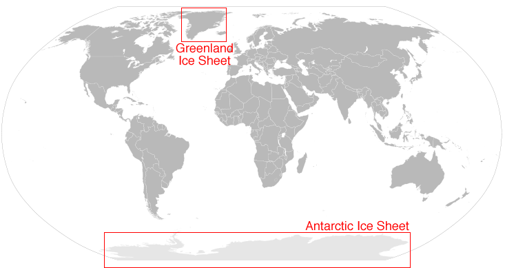
Together, the Greenland and Antarctic Ice Sheets contain
more than 99 percent of the freshwater ice on Earth.
Image Source: NSIDC
Ice sheets are large glaciers or masses of ice and snow that cover more than 50,000 square kilometers. Ice sheets form when winter snow does not melt completely during the summer months. There are two ice sheets on Earth and they cover most of Greenland and Antarctic. These ice sheets contain more than 99% of the freshwater ice on Earth!
Mountain glaciers develop high in mountainous regions and are found in northern Canada, on Antarctica, and in the Andes and Himalayas, and Alps. While mountain glaciers are melting at an unprecedented rate, they are not melting everywhere.
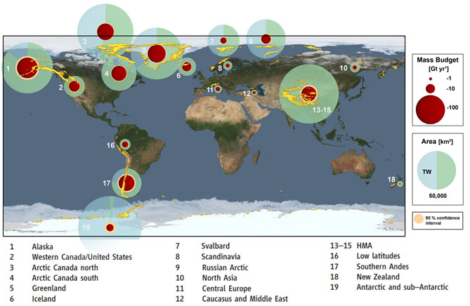
Change in glacial mass is determined by a combination of satellite altimetry (ICESat), satellite gravimetry (GRACE), and field observations. The red circles indicate glacial mass loss from 2003 to 2009. The largest glacial mass loss has occurred in Alaska, Arctic Canada, Greenland, the Himalayans, and the southern Andes.
Antarctic Ice Sheet
The continent, Antarctica, is isolated from the rest of the climate system by global winds and the Antarctic Circumpolar Current. The continent is covered by an ice sheet averaging 1.6 kilometers (1 mile) in thickness. The Antarctic Ice Sheet covers an area larger than the U.S. and Mexico combined. The Antarctica ice sheet contains 90% of the fresh water on Earth. If all of this ice on Antarctica melted, global sea level would rise at least 61 meters (200 feet).
There are three areas of this vast ice sheet that are affected by global warming in different ways.
The East Antarctica Ice Sheet, containing about 83% of the ice, sits on the continental landmass and is very stable. The West Antarctica Ice Sheet, containing 13% of the ice, developed over underwater islands. This sheet is unstable with potential to melt causing sea levels to rise approximately 5 to 6 meters (16 to 20 feet). In the spring of 2014 scientists at NASA and University of Irvine, California published a study concluding the West Antarctica Ice Sheet appears to be in an irreversible state of decline. The following video explains the study’s findings.
Video Source: NASA Jet Propulsion Laboratory
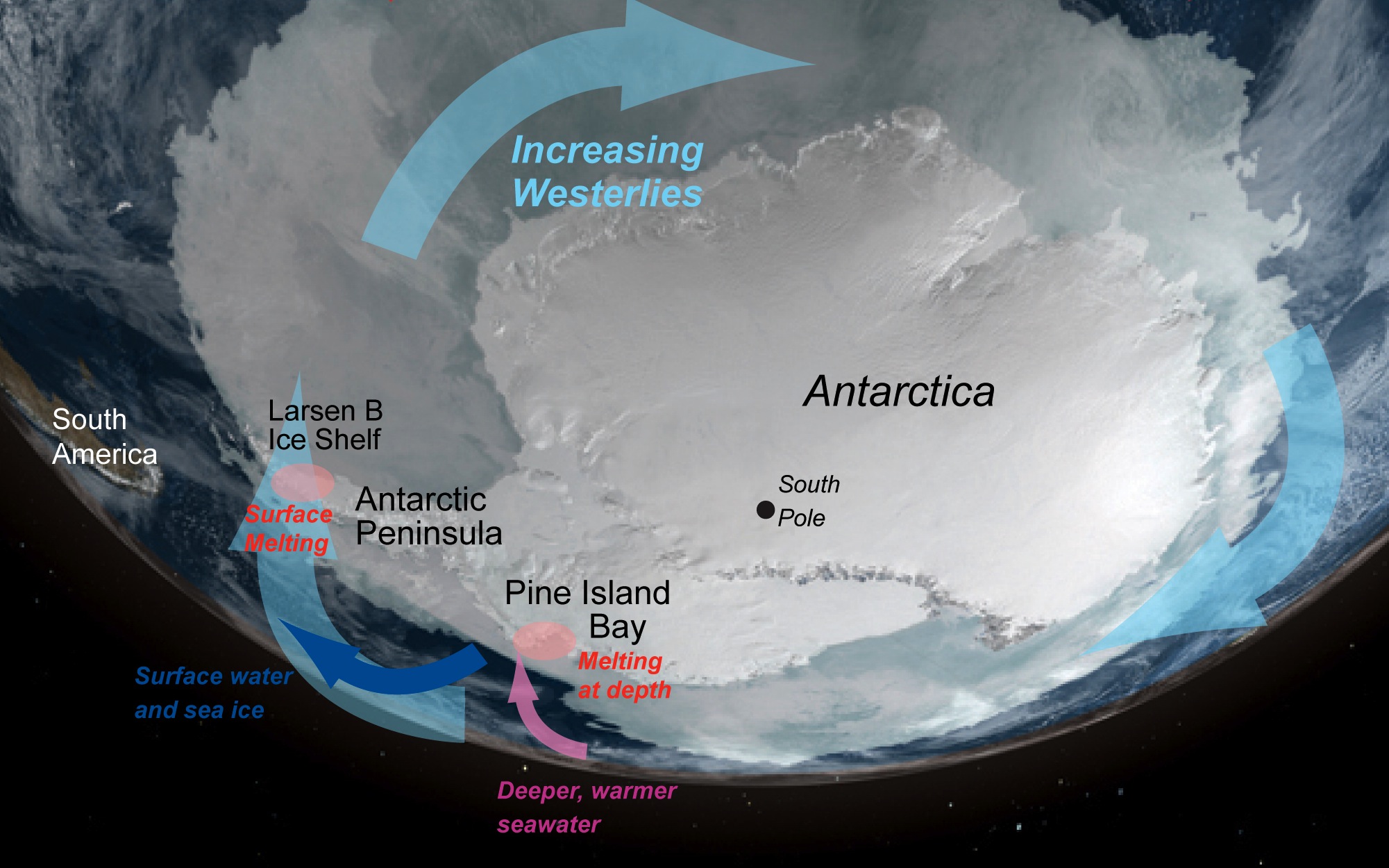
Rising ocean temperatures are melting the ice from underneath. Once the West Antarctica ice shelves melt, ice streams can accelerate. Ice streams, which are deep and fast flowing rivers of ice, make up the edge of this huge ice sheet. They are channelized glaciers that flow more rapidly than the surrounding mass of ice. Also, the interior of the ice sheet can melt more rapidly causing the entire West Antarctica Ice Sheet to collapse.
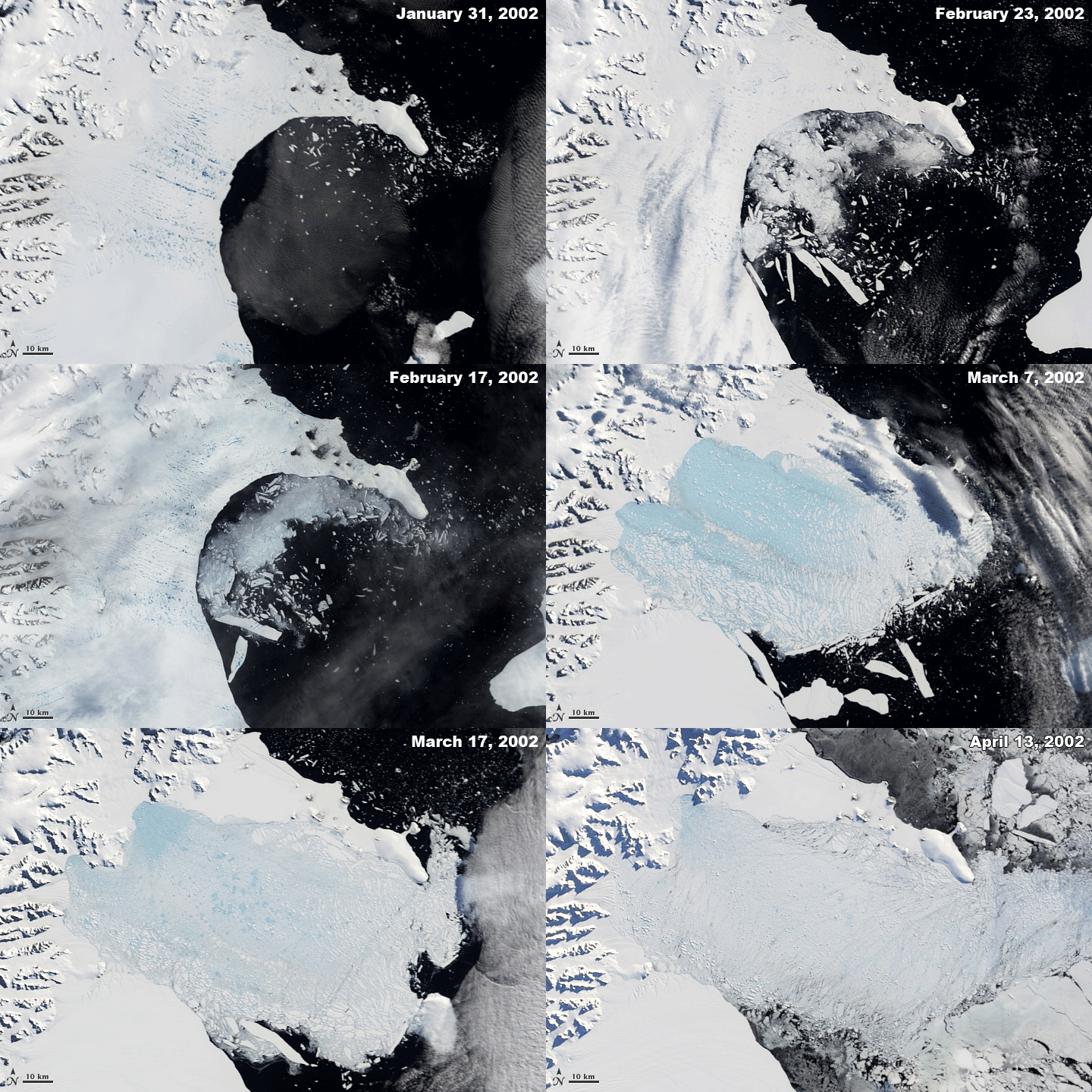
In recent decades, the third area of the ice sheet covering Antarctica, the Antarctic Peninsula has also been showing significant effects of warming ocean currents. In 2002, the 12,000-year-old Larsen B Ice Shelf on the northeast margin of the peninsula suddenly collapsed over a few days. An ice shelf is an area that occurs when an ice sheet extends over the sea. Events such as this reveal that ice shelves can rapidly collapse.
Greenland Ice Sheet
Greenland was named by Erik the Red, the first European settler around the year 982. Erik the Red named the island “Greenland” to lure more colonists. The large island, more than four times the size as Texas, is covered by snow and ice. Some areas of ice can be as thick as 2 kilometers (1.2 miles) and as old as 110,000 years. An ice cap, a miniature ice sheet covering less than 50,000 square kilometers, covers 80% of Greenland. An ice cap is usually centered on the highest area of a mountain and ice flows away toward the ice cap’s edges. The Greenland ice sheet is the second largest mass of ice on Earth next to Antarctica.
Over the last century, the average temperature of Greenland has risen by as much as 3°C (5.4° F). This warming is causing the exterior edges of the ice sheets, as well as the associated glaciers, to melt at a rapid rate.
There has also been an increase in the number of days that meltwater flows along the surface of the ice. As flow increases, vertical channels known as moulins can form in the ice sheet. Moulins appear like the “potholes” in the ice sheets. The meltwater flows downward through the moulin to the bedrock and acts as a lubricant at the base of the glacier. This allows the glacier to flow more easily, which enhanced melting further.
During the summer melt season, melt water accumulates in undulations on the surface of the Greenland ice sheet. Eventually, these melt lakes drain through crevasses or moulins (tunnels under the ice sheet surface), delivering water to the bottom of the ice sheet. This melt water lubricates the interface between the ice and the bedrock, causing the ice to flow faster toward the sea during summer. As summer melt increases and more melt water is available, the greater its effect on summer ice sheet flow rates. Video Source:
NASA/Goddard Space Flight Center Conceptual Image Lab


