EXPLORATION 4
US Wildfire Activity Web Map
 ArcGIS is a mapping platform developed by ESRI, an international supplier of Geographic Information System (GIS) software, web GIS and geodatabase management applications. In this exploration, you will study Wildfire data from NASA, NOAA and USGS. This data is included in this online version of ArcGIS. For the data to be visible, you will need to zoom in and move the map using your mouse or track pad.
Launch the US Wildfire Activity Web Map webpage.
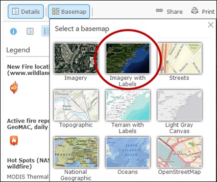
Before answering the questions, change the Basemap to Imagery with Labels (see image on right).
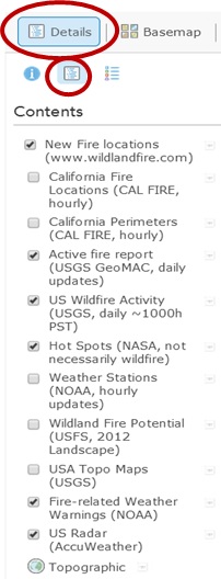 Under Details>Show Contents of Map, make sure that the contents shown checked in the image to the right are the same as on your map. Click on Legend under Details to begin.
- What areas of the U. S. have been identified as having multiple Hot Spots
 according to MODIS Thermal images?
 - Make sure that you are zoomed in enough to see the Hot Spots. Now search across the U. S. for current locations for other types of wildfire activity. If you don’t see the following symbols, answer
N/A
. Where in the U. S. are there:
- New Fire locations

- Active fire reports

- Fire-related Weather Warnings

- New Fire locations
- Search around the world. Find other countries that have multiple Hot Spots. List at least 5 locations in different countries.