Scientists' Explanation for Exploration 3A
Florida’s Past Sea Level
Map A illustrates what Florida’s coastline may have looked like approximately 120,000 years ago. Earth was in an interglacial period, where much of the ice on the planet had melted. Therefore, sea level would have been about 6 meters (20 feet) higher than today.
The last Glacial Maximum was about 18,000 years ago. During this time, the planet was covered with a large volume of ice. Because much of the water on the planet was frzoen in the glaciers, sea levels would have been as much as 120 meters (420 feet) lower than they are today. Florida would have been about double its current size.
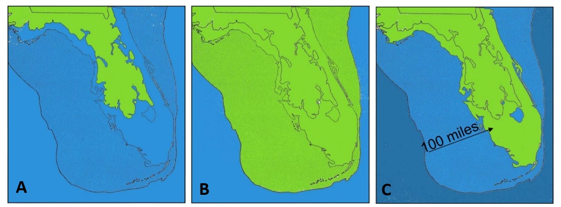
Florida During the Past Interglacial, Glacial, and Present. Image Source: Wanless