POSTER ABSTRACTS & PRESENTATIONS
Posters will be displayed and presenters available for discussion
5:15pm to 7:00pm
Wednesday, October 1
Rosen PLAZA Ballroom Foyer
Hors D'oeuvres and beverages will be served
Use of Supplemental Nest Structures by Key Largo Woodrats
Christina Alligood
Research Fellow, Animal Behavior
Disney's Animal Kingdom
1200 North Savannah Circle East
Bay Lake, FL 32830
407-938-2556
Christy.X.Alligood.-ND@disney.com
The Key Largo woodrat (Neotoma floridana smalli) is a nocturnal rodent endemic to tropical hardwood hammock on the island of Key Largo, FL. The species was declared endangered in 1984 after numerous studies placed its population in sharp decline. Reports have suggested that a limiting factor in the survival of the population may be a lack of viable nesting material and nesting sites. Therefore, 152 specially-designed supplemental nest structures have been placed in Crocodile Lake National Wildlife Refuge (CLNWR) since 2004. We completed a trapping survey of the structures. Forty-two unique woodrats were trapped at 53 structures. Hispid cotton rats (Sigmodon hispidus) and endangered Key Largo cotton mice (Peromyscus gossypinus allapaticola) also were trapped at the structures. At one supplemental nest structure, we fitted two infrared video cameras, which allowed us to document Key Largo woodrat presence and behavior as well as the presence of other animals in the nest structure. Woodrat presence observed at the site was relatively high compared to non-predator (e.g., crabs, snails, etc.) and predator (e.g., snake) presence throughout the observation period (February through December, 2007). Woodrat presence did not fluctuate with the rate of non-predator or predator visits. Woodrats observed in the structure engaged in a wide range of species-typical behavior. Taken together, these data support the contention that supplemental nest structures are readily used by the Key Largo woodrat population in CLNWR. This type of structure may become an increasingly important management tool as climate change affects ecosystem health in the Florida Keys.
Co-authors:
Joanne M. Potts
University of St. Andrews, Centre for Research into Ecological and Environmental Modelling
Clayton DeGayner
Friends and Volunteers of Refuges, Florida Keys
Ralph DeGayner
Friends and Volunteers of Refuges, Florida Keys
Anne Savage
Disney's Animal Kingdom, Education and Science Department
Ocean Acification, Bioindicators and Florida Reefs
Kelley Anderson
Graduate Assistant
College of Marine Science, University of South Florida
140 7th Avenue South
Saint Petersburg, FL 33701
352-284-7368
kanderson@marine.usf.edu
Ocean acidification is the latest of emerging climate change concerns. Florida's economic reliance on tourism and fishing should make acidification impacts a high research priority. The concentration of CO2 in the atmosphere will reach twice the preindustrial level by the middle of this century. This increase will reduce the calcium carbonate saturation state of the surface ocean by 30% relative to the preindustrial level, which will inhibit calcification rates of corals and other reef-building organisms. Thus, ocean acidification reduces the probability for recovery of coral populations that have been declining since the 1970s. The loss of reef cover has far-reaching implications; these reefs are crucial habitat without which fish populations will suffer seriously. Reefs also protect low lying coastlines from storm waves.
Foraminifera are shelled marine protists whose fossils are widely used in oil exploration and paleoceanographic research. Strategies also are being developed to use foraminifers as bioindicators of environmental conditions that support coral growth. Assemblages in reef sediments can indicate if water quality is suitable for reef growth. Shell abnormalities are being investigated as an indicator of ocean acidification, while other species exhibit bleaching similar to that in corals. The Reef Indicators Lab at the University of South Florida is collaborating with researchers and managers in the Environmental Protection Agency, NOAA the US Geological Survey and other agencies to further develop these promising tools. Resulting data will be utilized as part of graduate students. theses and for long-term monitoring.
Utilizing LIDAR to Model Sea Level Rise Effects in the Florida Keys
Alison Higgins
The Nature Conservancy
55 North Johnson Road
Sugarloaf Key, FL 33042
305-745-8402 x 111
ahiggins@tnc.org
The Florida Keys are home to 24 federally endangered and over 100 state-listed plant and animal species. From end to end, the islands contain two National Parks, four National Wildlife Refuges, 11 State parks, 16 State Wildlife Environmental Areas, and hundreds of acres of municipal conservation areas. Technological tools that provide precise elevational ranges can help land managers prioritize their efforts for habitat management and acquisition in the years to come.
LIDAR (Light Detection and Ranging) is a technological system used to obtain very accurate elevation maps of an area. LIDAR equipment is attached to an airplane and flown over the area of interest while emitting pulses of light that are reflected from objects below back to sensors on the airplane. The elevation of the ground, cars, tree tops, buildings, even people, are all recorded by the device along with the exact position of the aircraft. Once the data is collected it can be processed on a computer and two maps can be created, one displaying the tops of vegetation and the other depicting the bare ground. LIDAR is beneficial because of its speed and precision of measurements. The current vertical error of the Big Pine Key datasets is +/- 5 cm with a horizontal resolution of 1m.
Overlaying sea level rise scenarios from the International Panel for Climate Change onto these elevational gradients shows not only which habitats will experience greatest change, but in what order. Even with the best case scenario, sea level rise of 18cm by 2100 will cause a 38% loss of upland habitats, an 18% loss in transitional habitats. The worst case scenario from the original IPPC report evidences an 86% loss of uplands and 71% loss in transitional habitats. A 1m rise in sea level will result in a 97% loss of uplands and 89% loss of transitional habitats.
Co-authors:
Chris Bergh
The Nature Conservancy
55 North Johnson Road
Sugarloaf Key, FL 33042
Mike Ross
Associate Research Scientist
Florida International University - Southeast Environmental Research Center
11200 SW 8th Street
Miami, FL 33199
Keqi Zhang
Assistant Professor
Florida International University - International Hurricane Research Center
11200 SW 8th Street
Miami, FL 33199
A Plant Phenology Network for the Southeastern United States
George R. Kish
U.S. Geological Survey
Florida Integrated Science Center
10500 University Center Dr., Suite 215
Tampa, FL, 33612
813-975-8620, ext. 134
gkish@usgs.gov
Plant phenology is increasingly recognized as a vital approach for understanding how ecosystems respond to climatic changes. Spatially extensive patterns of phenological observations have been closely linked to climate variability; several studies have demonstrated a trend of earlier leaf emergence and bloom dates over the last several decades for lilac and cloned lilac species in the northern U.S. The USA National Phenology Network (USA-NPN) has been established to integrate phenological event observations on a national level with remotely-sensed weather and vegetation data. Initially, the network focused on the north-central portions of the continental U.S but is currently being extended to include the southeastern U.S. in order to provide a framework for quantifying the effects of climate changes unique to the Southeast.
The Intergovernmental Panel on Climate Change (IPCC) projections for the southeastern U.S. suggest that higher maximum summer temperatures, higher evapotranspiration rates, and higher rainfall intensities combined with longer periods without rainfall will occur. The Southeastern Coastal Plain is relatively flat with a significant portion of the landscape comprised of swamps, marshes, and floodplain wetlands adjacent to slow-moving streams. Plant community structure and ecosystem dynamics in the Southeastern Coastal Plain have developed under conditions of abundant water close to the land surface. Prolonged droughts, higher maximum summer temperatures, and higher evapotranspiration rates may stress plant communities and cause shifts in the spatial extent of sensitive species, changes in community structure along hydrologic gradients, and changes in diversity and ecosystem function. Projected effects of climate change in the southeastern U.S. are: (1) accelerated wildfire frequency resulting from longer periods without rainfall, (2) reduced soil moisture available for plant transpiration, (3) increased infestation of southern forest stands by pine bark beetles, and (4) changed ecosystem community dynamics.
Establishing the network in the southeastern United States is of outmost importance as the southeast is probably the most difficult of regions in the United States to distinguish regional climate change effects from the variability imposed by local weather effects. The magnitude of climate changes will likely be less severe in the southeast than in colder regions, but no less important to ecosystem dynamics. A plant phenology network for the southeastern U.S. will consist of a tiered approach consistent with the USA-NPN and include: (1) intensive sites focused on process studies, (2) spatially extensive environmental networks focused on standardized observations, (3) scientific networks with educational components (college campuses, nature preserves with educational programs, etc.), and (4) remote-sensing products that can be assimilated to extend surface observations.
Modeling Landscape Habitat Shifts from Climate Change in Everglades National Park
Leonard Pearlstine
Landscape Ecologist
National Park Service, Everglades National Park
950 N Krome Ave.
Homestead, FL 33030
305-224-4228
leonard_pearlstine@nps.gov
Both Everglades restoration and sea-level rise may cause substantial spatial changes in habitat availability and location in Everglades National Park. The Biological Resources Branch at Everglades and Dry Tortugas National Parks has initiated a modeling effort to assist predictions of the interaction of sea-level rise and restoration alternatives on estuarine and inland habitats. Landscape-level habitat models are coupled to TIME hydrologic model outputs to provide decision-support for restoration and sea-level rise scenarios. Initial habitat suitability models have been constructed for juvenile spotted seatrout (Cynoscion nebulosus), blue crab (Callinectes sapidus), amphibian communities, and turtle grass (Thalassia testudinum). Vegetation community succession models are in development as a central element in identification of potential shifts in distribution of floral, and consequently, suitable faunal habitat. Vegetation modeling will attempt to include climate change effects such as precipitation, temperature and fire pattern changes on succession and spatial distribution of communities. Habitat models for additional estuarine and inland wildlife species are planned in cooperation with USGS and university researchers. This study is one part of a developing climate change program to provide spatial decision support assessment tools for the landscape-scale assemblages of habitats needed to support Everglades National Park fish and wildlife resources.
David Hallac Everglades and Dry Tortugas National Parks
William Perry Everglades and Dry Tortugas National Parks
Tom Schmidt Everglades and Dry Tortugas National Parks
Steve Friedman Everglades and Dry Tortugas National Parks
Kiren Bahm Everglades and Dry Tortugas National Parks
Jimi Sadle Everglades and Dry Tortugas National Parks
Eric Swain U.S. Geological Survey
Kevin Chartier University of Florida
Tracy Ziegler Everglades and Dry Tortugas National Parks
Wildlife Habitat Planning Strategies, Design Features and Best Management Practices for Florida Communities and Landowners
Dan Pennington
1000 Friends of Florida
926 East Park Avenue
Tallahasee, FL 32301
850-222-6277 x 105
dpennington@1000fof.org
1000 Friends of Florida has just completed a project to develop a document addressing wildlife habitat planning strategies, design features and best management practices for Florida communities and landowners. The project was made possible by a grant from Florida's Wildlife Legacy Initiative. The product of this effort was to identify and document a series of planning tools, design features and approaches that can be used by local governments, landowners and others to conserve, link and sustain important wildlife habitat in Florida as our landscapes continue to develop. Printed and on line versions of the document are available. For the on line version go to www.floridahabitat.org and then to the manual button and click.
A tale of two seawalls: A case study of the impact of coastal armoring on Loggerhead sea turtle nesting
Carol E. Rizkalla and Anne Savage
Disney's Animal Kingdom
PO Box 10000
Lake Buena Vista, FL 32830
407-938-2930
Carol.X.Rizkalla.-ND@disney.com
Previous research has shown that seawalls negatively impact loggerhead sea turtle nesting as there are fewer emergences and fewer nests in front of a seawall. It has also been suggested that the further landward a seawall is located, the lower the impact on sea turtle nesting. Presumably this would lessen the likelihood that a nest is inundated or washed away during high water events. We analyzed loggerhead nesting attempts along a 6.7 km stretch of beach in Indian River County, Florida, where 2 seawalls have been installed. The Summer Place seawall was constructed in 1996 and provides approximately 5 m of beach above the high tide line. Data collected during the 2003-2007 nesting seasons showed there were significantly fewer loggerhead sea turtle nests in front of the seawall when compared to a similar length of unarmored beach. However, the density of false crawls in front the seawall was not greater than expected. The Sea Oaks seawall was constructed in the winter of 2007, and provides approximately 20 m of beach above the tide line. During the 2007 nesting season, there were fewer loggerhead sea turtle nests in front of this seawall when compared to unarmored beach. Additionally, there was no difference in nest density between the 2 seawalls. Analyses of hatching success indicate that the greatest impact of coastal armoring on sea turtle nests occurs during large storm events. Thus, our data suggest that regardless of the width of beach in front of sea walls, sea turtles deposit fewer nests in front of seawalls than unarmoured beach. With the high incidence of storms that occur each year in Florida, seawalls continue to negatively impact the survival of sea turtles and pose a threat to their long-term survival.
Role of Climate in Predicting Invasion Dynamics of Two Exotic Invaders in a North Florida Forest Ecosystem
Nitesh Tripathi
Postdoctoral Research Associate
University of Florida
369 Newins-Ziegler Hall
Gainesville, FL 32611
352-846-0120
nitesh@ufl.edu
Florida has become the national epicenter of alien plant introductions. Climate plays an important role in the introduction and spread patterns of invasive species. Millions of acres of forestland in Florida are being occupied by alien invasive plants threatening their ecological and economic integrity. We evaluated the effects of climate on the future establishment and spread of Florida's two most notorious exotic species: Lygodium japonicum (Japanese climbing fern) and Imperata cylindrica (cogon grass) using Blackwater river state forest, a 195,000 acres forest in northwestern Florida as the study site. We used ecological niche modeling to test the hypotheses that occurrence of each invasive species on the landscape was closely associated with specific climatic variables. A total of 534 and 384 occurrence points for L. japonicum and I. cylindrica respectively were used for the modeling activity. Results indicated that growth patterns of both Japanese climbing fern and cogon grass were mostly affected by precipitation. Cogon grass spread patterns were most affected by .precipitation of wettest month. whereas Japanese climbing fern was largely affected by .annual precipitation.. It was concluded that future spread patterns of both species relative to climate can be accurately predicted using ecological niche modeling. The model can be calibrated and used for the entire state of Florida or elsewhere in the southeastern U.S and can serve as a tool to predict invasion patterns of other invasive plants as affected by climate of the region.
Co-author:
Shibu Jose
Associate Professor
School of Forest Resources and Conservation
University of Florida
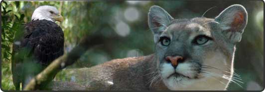
Global Climate Change and Its Effects on Large Carnivore Habitat in Florida
Andrew Whittle
Graduate Student
University of Kentucky Department of Forestry
105 T.P. Cooper Building
Lexington, KY 40546
859-816-8197
andrew.whittle@uky.edu
Florida is an especially timely example of the potential negative impacts of climate change on biodiversity. Forecasted effects of global warming on Florida include increased hurricane intensity, an estimated temperature increase of nearly 3°F by 2025, sea level rise of 0.5 m . 5m, and a 10% annual decrease in precipitation - all of which could have profound ecological effects on Florida's unique peninsular ecosystems and biota. We applied several prominent climate change models to the habitats of Florida black bear (Ursus americanus floridanus) and Florida panther (Puma concolor coryi), two wide-ranging carnivores that have experienced dramatic post-Columbian range reductions. Our predictive model indicated that a climate change-induced sea level rise of only 1 m will reduce black bear habitat in Florida by 9%, and Florida panther habitat by 29 %, at 3 m by 20% and 62%, at 5 m by 31% and 90% respectively. The consequences are particularly dire for the panther which has no other populations outside of low-lying south Florida. Cost surface analyses identified likely migration routes that would link south Florida bear and panther populations to suitable habitat to the north. However, without rapid conservation actions that establish populations to the north, we predict that the Florida panther may go extinct in the wild due to climate change effects.
Co-authors:
David S. Maehr
University of Kentucky, Department of Forestry
105 T.P. Cooper Building
Lexington, KY 40546
Songlin Fei
University of Kentucky, Department of Forestry
105 T.P. Cooper Building
Lexington, KY 40546
John Cox
University of Kentucky, Department of Forestry
105 T.P. Cooper Building
Lexington, KY 40546