|
Pre-settlement Extent of the Florida Dry Prairie Landscape
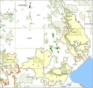 |
Prepared
from original land surveys conducted mostly between 1820 and
1870, this map shows the estimated presettlement extent (not
what remains today) of the dry prairie landscape. Florida
dry prairie landscape includes several plant communities: dry
prairie, prairie hammocks, depression ponds/marshes, saw-grass
marshes, wet wiregrass prairies, and
other plant community types.
Map Created by: Edwin Bridges |
|
Legend
|
 |
Florida
Dry Prairie Landscape |
 |
Managed
Areas - Conservation managed areas (Ex. Avon Park Air Force Range,
Bright Hour Ranch, Myakka River State Park, etc.) |
|
|
For more information
contact: Doreen DiCarlo at CES
Phone: 561-799-8553 | Fax: 561-626-1404
| E-mail: ddicarlo@ces.fau.edu
|
|